Arş.Gör.Dr. Ozan Öztürk
Ana Sayfa
Eğitim Bilgileri
Araştırma Alanları
Akademik İdari Deneyim
Yayınlar & Eserler
Proje & Patent & Tasarım
Bilimsel Faaliyetler
Başarılar & Tanınırlık
Duyurular & Dokümanlar
İletişim
İstanbul Teknik Üniversitesi
Akademik Veri Yönetim Sistemi
English
Akademik Veri Yönetim Sistemi
English
Yayınlar & Eserler
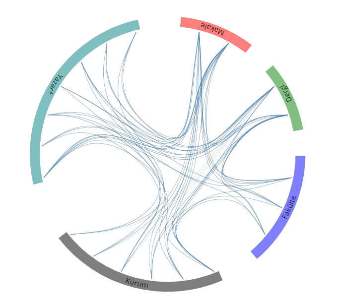
Yayın Ağı
SCI, SSCI ve AHCI İndekslerine Giren Dergilerde Yayınlanan Makaleler
Improving Road Segmentation by Combining Satellite Images and LiDAR Data with a Feature-Wise Fusion Strategy
Öztürk O.
,
Işık M. S.
,
Kada M.
,
Şeker D. Z.
APPLIED SCIENCES
, cilt.13, sa.10, ss.6161-6179, 2023 (SCI-Expanded)
Performance evaluation of shallow and deep CNN architectures on building segmentation from high-resolution images
Sarıtürk B.
,
Şeker D. Z.
,
Öztürk O.
,
BAYRAM B.
EARTH SCIENCE INFORMATICS
, cilt.15, sa.3, ss.1801-1823, 2022 (SCI-Expanded)
Generation of Istanbul road data set using Google Map API for deep learning-based segmentation
Öztürk O.
,
Işık M. S.
,
Sarıtürk B.
,
Şeker D. Z.
INTERNATIONAL JOURNAL OF REMOTE SENSING
, cilt.43, sa.8, ss.2793-2812, 2022 (SCI-Expanded)
INVESTIGATION OF POTENTIAL USAGE OF UAV BASED PHOTOGRAMMETRY AND LIDAR FOR FOREST INVENTORY
Sarıtürk B.
,
Öztürk O.
,
Vardar E.
,
Şeker D. Z.
FRESENIUS ENVIRONMENTAL BULLETIN
, cilt.31, sa.8A, ss.8475-8481, 2022 (SCI-Expanded)
CONTRIBUTIONS OF OPEN SOURCE TOOLS FOR ROAD DATA PRODUCTION IN DEEP LEARNING APPLICATIONS
Öztürk O.
,
Sarıtürk B.
,
Şeker D. Z.
FRESENIUS ENVIRONMENTAL BULLETIN
, cilt.31, sa.8A, ss.8542-8546, 2022 (SCI-Expanded)
An automatic image matching algorithm based on thin plate splines
Atik M. E.
,
Öztürk O.
,
Duran Z.
,
Şeker D. Z.
EARTH SCIENCE INFORMATICS
, cilt.13, ss.869-882, 2020 (SCI-Expanded)
OBJECT BASED CLASSIFICATION OF UNMANNED AERIAL VEHICLE (UAV) IMAGERY FOR FOREST FIRES MONITORING
Bilgilioglu B. B.
,
Ozturk O.
,
Sariturk B.
,
Seker D. Z.
FRESENIUS ENVIRONMENTAL BULLETIN
, cilt.28, sa.2, ss.1011-1017, 2019 (SCI-Expanded)
Diğer Dergilerde Yayınlanan Makaleler
Comparison of Fully Convolutional Networks (FCN) and U-Net for Road Segmentation from High Resolution Imageries
ÖZTÜRK O.
,
SARITÜRK B.
,
ŞEKER D. Z.
International Journal of Environment and Geoinformatics
, cilt.7, sa.3, ss.272-279, 2020 (Hakemli Dergi)
3D Object Recognition with Keypoint Based Algorithms
ATİK M. E.
,
İNCEKARA A. H.
,
SARITÜRK B.
,
ÖZTÜRK O.
,
DURAN Z.
,
ŞEKER D. Z.
International Journal of Environment and Geoinformatics
, cilt.6, sa.1, ss.139-142, 2019 (Hakemli Dergi)
İnsanız Hava Aracı (İHA) Görüntüleri İle Ortofoto Üretiminde Yükseklik Ve Kamera Açısının Doğruluğa Etkisinin Araştırılması
ÖZTÜRK O.
,
BİLGİLİOĞLU B. B.
,
ÇELİK M. F.
,
BİLGİLİOĞLU S. S.
,
ULUĞ R.
Geomatik Dergisi
, cilt.2, sa.3, ss.135-142, 2017 (Hakemli Dergi)
Hakemli Kongre / Sempozyum Bildiri Kitaplarında Yer Alan Yayınlar
Building Extraction from High-Resolution Images Using Deep Learning Approach
SARITÜRK B.
,
ÖZTÜRK O.
,
ŞEKER D. Z.
,
BAYRAM B.
International Symposium on Applied Geoinformatics (ISAG 2019), İstanbul, Türkiye, 7 - 09 Kasım 2019
Comparison of FCN and U-Net for Image Segmentation Using High Resolution Images and Aerial Orthophoto Maps
ÖZTÜRK O.
,
SARITÜRK B.
,
ŞEKER D. Z.
International Symposium on Applied Geoinformatics (ISAG 2019), İstanbul, Türkiye, 7 - 09 Kasım 2019
Usage of Deep Learning for Image Segmentation from High Resolution Images,
ÖZTÜRK O.
,
ŞEKER D. Z.
,
BAYRAM B.
,
DURAN Z.
Türkiye Ulusal Fotogrametri ve Uzaktan Algılama Birliği X. Teknik Sempozyumu, Aksaray, Türkiye, 25 - 27 Nisan 2019, ss.86-89
Contribution of Smartphones for Documentation of Cultural Heritage: A Case Study of Zilkale
ÖZTÜRK O.
,
SARITÜRK B.
,
İncekara A. H.
,
ŞEKER D. Z.
,
BAYRAM B.
,
DURAN Z.
39th Asian Conference on Remote Sensing (ACRS 2018, Kuala-Lumpur, Malezya, 15 - 19 Ekim 2018, cilt.4, ss.2393-2400
3D Object Recognition with Keypoint Based Algorithms
ATİK M. E.
,
İNCEKARA A. H.
,
SARITÜRK B.
,
ÖZTÜRK O.
,
DURAN Z.
,
ŞEKER D. Z.
EURASIAN GIS 2018 CONGRESS, 4 - 07 Eylül 2018, cilt.1, ss.126-129
GIS BASED ACCURACY ASSESSMENT OF MULTI-RESOLUTION SEGMENTATION
DELEN A.
,
İNCEKARA A. H.
,
ÖZTÜRK O.
,
ŞEKER D. Z.
EURASIAN GIS CONGRESS 2018, 4-7 September, Bakü, Azerbaycan, Baku, Azerbaycan, 4 - 07 Eylül 2018, ss.75
Road network extraction by using combination of lidar and high resolution orthoimage
Öztürk O.
,
İncekara A. H.
,
Bayram B.
,
Şeker D. Z.
,
Duran Z.
EurasianGIS2018, Baku, Azerbaycan, 4 - 07 Eylül 2018, ss.38
Dsm Production With Thin Plate Splines Algorithm And Accuracy Analysis
Atik M. E.
,
Sarıtürk B.
,
Duran Z.
,
Şeker D. Z.
,
Öztürk O.
EurasianGIS2018, Baku, Azerbaycan, 4 - 07 Eylül 2018, ss.36
A Combination Example of Terrestrial and Unmanned Aerial Vehicle (UAV) Photogrammetry for 3D Documentation: Zilkale
ÖZTÜRK O.
,
SARITÜRK B.
,
ŞEKER D. Z.
,
BAYRAM B.
,
DURAN Z.
ICOMOS Inter-ISC Meeting and Colloquium, Kastamonu, Türkiye, 10 - 13 Temmuz 2018
Combination of UAV Based Digital Surface Model With 3D Model of ITU Bicycle House Produced by Close-Range Photogrammetry
ALBENİ Y.
,
SARITÜRK B.
,
ATİK M. E.
,
ÖZTÜRK O.
,
DURAN Z.
,
ŞEKER D. Z.
, et al.
ICOMOS Inter-ISC Meeting and Colloquium, Kastamonu, Türkiye, 10 - 13 Temmuz 2018
ANALYSIS OF NATURAL LAND COVER CHANGE USING TIME SERIES: A CASE STUDY OF ISTANBUL
SARITÜRK B.
,
ATİK M. E.
,
ALGANCI U.
,
ÖZTÜRK O.
,
DURAN Z.
,
ŞEKER D. Z.
4th International Water and Environment Fair and Congress, Bursa, Türkiye, 22 - 24 Nisan 2018
Comparison of 3D Models Generated from Images and Video File Using SFM Technique
SARITÜRK B.
,
ÖZTÜRK O.
,
TOPALOĞLU R. H.
,
ŞEKER D. Z.
International Symposium on GIS Applications in Geography and Geosciences, Çanakkale, Türkiye, 18 - 21 Ekim 2017
Temporal Monitoring of Landslide Using Images Obrained from UAV
ÖZTÜRK O.
,
SARITÜRK B.
,
ŞEKER D. Z.
International Symposium on GIS Applications in Geography and Geosciences, 18 - 21 Ekim 2017
Monitoring of Forest Fires Using Low-Budget Unmanned Aerial Vehicles
ÖZTÜRK O.
,
SARITÜRK B.
,
ŞEKER D. Z.
,
GÖZEL M. M.
19th International Symposium on Environmental Pollution and its Impact on Life in the Mediterranean Region, 4 - 06 Ekim 2017
Determining the Quantification of Coastal Erosion Using UAV A Case Study of Trabzon-Turkey
SARITÜRK B.
,
ÖZTÜRK O.
,
ŞEKER D. Z.
19th International Symposium on Environmental Pollution and its Impact on Life in the Mediterranean Region, 4 - 06 Ekim 2017
İnsansız Hava Araçlarının Dere Yataklarının Haritalanması Çalışmalarında Kullanılması: Zil Deresi Örneği
Öztürk O.
,
Zihni H.
,
Akdeniz O.
,
Ertaş M. A.
,
Şeker D. Z.
Harita ve Kadastro Mühendisleri Odası (HKMO). 16. Türkiye Harita Bilimsel Ve Teknik Kurultayı, Ankara, Türkiye, 3 - 06 Mayıs 2017, ss.1
İnsanız Hava Aracı (İHA) Görüntüleri İle Ortofoto Üretiminde Yükseklik Ve Kamera Açısının Doğruluğa Etkisinin Araştırılması
Öztürk O.
,
Bilgilioğlu B. B.
,
Çelik M. F.
,
Bilgilioğlu S. S.
,
Uluğ R.
Türkiye Ulusal Fotogrametri ve Uzaktan Algılama Birliği (TUFUAB) 9. Teknik Sempozyumu, Afyon, Türkiye, 27 - 29 Nisan 2017, ss.71-74
Object-based classification of unmanned aerial vehicle (UAV) imagery for forest fires monitoring
BİLGİLİOĞLU B. B.
,
ÖZTÜRK O.
,
SARITÜRK B.
,
ŞEKER D. Z.
38th Asian Conference on Remote Sensing - Space Applications: Touching Human Lives, ACRS 2017, New Delhi, Hindistan, 23 - 27 Ekim 2017
Metrikler
Daha fazla metrik
Yayın
31
Atıf (WoS)
9
H-İndeks (WoS)
3
Atıf (Scopus)
11
H-İndeks (Scopus)
3
Proje
2
Açık Erişim
1
BM Sürdürülebilir Kalkınma Amaçları


 Yayın Ağı