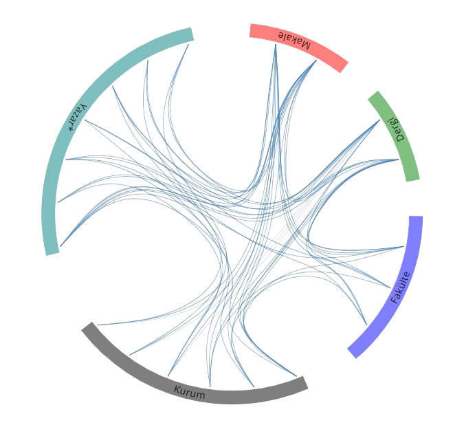
SCI, SSCI ve AHCI İndekslerine Giren Dergilerde Yayınlanan Makaleler
An alternative processing strategy in Global Positioning System densification networks
Experimental Techniques
, cilt.34, sa.5, ss.59-67, 2010 (SCI-Expanded)
Diğer Dergilerde Yayınlanan Makaleler
An Investigation on 'Squat and the Exemption of Unauthorized Buildings-Gecekondu' in Turkey
Technika Chronika
, ss.81-85, 2008 (Hakemli Dergi)
Koordinat Dönüşümünde En Küçük Kareler ve Toplam En Küçük Kareler Yöntemleri
hkm Jeodezi, Jeoinformasyon ve Arazi Yönetimi Dergisi
, sa.97, ss.15-21, 2007 (Hakemli Dergi)
Local Geoid Surface Approximation by Fuzzy Inference Systems Case Studies in Turkey
Harita Dergisi
, ss.9, 2006 (Hakemli Dergi)
The stochastic modeling of GPS observations
Turkish Journal of Engineering and Environmental Sciences
, cilt.28, sa.4, ss.223-231, 2004 (Scopus)
Geoid Surface Approximation by Using Adaptive Network based Fuzzy Inference Systems
Allgemeine Vermessungs-Nachrichten
, ss.308-315, 2003 (Hakemli Dergi)
GPS İle Konum Belirlemede Stokastik Modellerin Etkileri
İTÜ Dergisi Mühendislik Serisi
, cilt.2, sa.1, ss.45-54, 2003 (Hakemli Dergi)
Hakemli Kongre / Sempozyum Bildiri Kitaplarında Yer Alan Yayınlar
A Variance Model of NRTK - derived positions as a function of baseline length
28th Conference “Surveying, Civil Engineering, Geoinformation in Sustainable Development, Bydgoszcz, Polonya, 2 - 10 Haziran 2020, ss.1
New Astrogeodetic Observations of Vertical Deflections at the Istanbul Astrogeodetic Network Demonstrate Issues in Global Gravity Models along Coastlines
International Union of Geodesy and Geophysics 27th General Assembly, Montreal, Kanada, 8 - 18 Temmuz 2019
Modernizing and Upgrading the Astrogeodetic Camera System for Determining Vertical Deflections
American Geophysical Union Fall Meeting 2017, New Orleans, Amerika Birleşik Devletleri, 11 - 15 Aralık 2017, ss.1
Demiryollarında CBS Entegrasyonuna Yönelik Politikaların Geliştirilmesi
12. Ulaştırma Kongresi-Ulaştırma Politikaları, Adana, Türkiye, 24 - 26 Mayıs 2017, ss.56-63
Soft Computing and Conventional Interpolation Methods in Geoid Modelling: A Case Study in Istanbul
JpGU-AGU Joint Meeting 2017, Chibe, Japonya, 23 - 25 Mayıs 2017, ss.1
İstanbul Astro-jeodezik Test Ağında Sayısal Zenit Kamera Sistemi Gözlemleri
16. Türkiye Harita Bilimsel ve Teknik Kurultayı, Ankara, Türkiye, 3 - 06 Mayıs 2017, ss.45-51
The integration of astro-geodetic data observed with ACSYS to the local geoid models Istanbul-Turkey
European Geosciences Union General Assembly 2017, Viyana, Avusturya, 23 - 28 Nisan 2017, ss.1
Calibration and Testing of Digital Zenith Camera System Components
European Geosciences Union General Assembly 2017, Viyana, Avusturya, 23 - 28 Nisan 2017, ss.1
An Investigation on the Use of Different Centroiding Algorithms and Star Catalogs in Astro-Geodetic Observations
European Geosciences Union General Assembly 2017, Viyana, Avusturya, 23 - 28 Nisan 2017, ss.1
Local Geoid Modelling using Astro-geodetic Camera System and GNSS/Leveling Data
American Geophysical Union Fall Meeting 2016, San Francisco, Amerika Birleşik Devletleri, 12 - 16 Aralık 2016, ss.1
Performance Analyis of Web-Based PPP Services With Different Visibility Conditions
American Geophysical Union Fall Meeting 2016, San Francisco, Amerika Birleşik Devletleri, 12 - 16 Aralık 2016, ss.1
An Investigation on the Contribution of GLONASS to the Precise Point Positioning for Short Time Observations
American Geophysical Union Fall Meeting 2016, San Francisco, Amerika Birleşik Devletleri, 12 - 16 Aralık 2016, ss.1
Geoit Belirleme Çalışmalarına Astro-Jeodezik Katkı: Sayısal Zenit Kamera Sistemleri
Türkiye Ulusal Jeodezi Komisyonu, İstanbul, Türkiye, 3 - 04 Kasım 2016, ss.1
Local Geoid Determination in Istanbul Metropolitan Area
European Geosciences Union General Assembly 2016, Viyana, Avusturya, 17 - 22 Nisan 2016, ss.1
TUCBS Açmazı” ve Açık Bir Ulusal Mekansal Veri Altyapısına Yönelim
15. Türkiye Harita Bilimsel ve Teknik Kurultayı, Ankara, Türkiye, 25 - 28 Mart 2015, ss.110-116
The Fate of a Fortress: Seddülbahir
International 4th Gallipoli Symposium, İstanbul, Türkiye, 15 - 16 Mart 2015, ss.10-15
Türkiye Yükseklik Sistemi ve Uygulamada Karşılaşılan Sorunlar
Türkiye Ulusal Jeodezi Komisyonu Yükseklik Sistemleri Çalıştayı, Zonguldak, Türkiye, 28 - 30 Mart 2012, ss.34-42
An Investigation on the ground characteristics and point displacements in Istanbul GPS network
American Geophysical Union Fall Meeting 2011, San Francisco, Amerika Birleşik Devletleri, 5 - 09 Aralık 2011, ss.1
İnterferometrik SAR ve Uygulamaları
Türkiye Ulusal Jeodezi Komisyonu 2010 Mekansal Planlamada Jeodezi Sempozyumu, İzmir, Türkiye, 24 - 26 Kasım 2010, ss.23-28
Spatial Data Quality: Accuracies of Positions and Heights
International Cartographic Congress, Santiago, Şili, 15 - 21 Kasım 2009, ss.1-6
An Investigation on the Crustal Deformations in Istanbul after Eastern Marmara Earthquakes in 1999
American Geophysical Union Fall Meeting 2008, San Francisco, Amerika Birleşik Devletleri, 15 - 19 Aralık 2008, ss.1
A Software Development for an Alternative GPS Processing Strategy
American Geophysical Union Fall Meeting 2008, San Francisco, Amerika Birleşik Devletleri, 15 - 19 Aralık 2008, ss.1
Mekansal Verinin Kalitesi: Konum ve Yükseklik Doğruluğu
TMMOB Coğrafi Bilgi Sistemleri ‘2007 Kongresi, Trabzon, Türkiye, 30 Ekim - 05 Kasım 2007, ss.1-6
Geodetic Infrastructure and Geospatial Data Standardisation for GIS Applications in Turkey
5th International Congress GEOMATICA 2007, Havana, Küba, 12 - 16 Şubat 2007, ss.1-6
Total Least Squares in Geodetic Coordinate Transformation
American Geophysical Union Fall Meeting 2006, San Francisco, Amerika Birleşik Devletleri, 11 - 15 Aralık 2006, ss.1
Global Congruency Test Methods in Deformation Networks: A case Study in Gürpınar
International Symposium on Modern Technologies, Education and Professional Practice in the Globalizing World, Sofya, Bulgaristan, 9 - 10 Kasım 2006, ss.212-216
Local Geoid Determination by Fuzzy Inference Systems: Case Studies in Turkey
The First Symposium of International Gravity Field Service: Gravity Field of the Earth, İstanbul, Türkiye, 28 Ağustos - 01 Eylül 2006, ss.1
Sufficiency of Geodetic Infrastructure of Turkey for GIS
26th Annual ESRI International User Conference, San Diego, Amerika Birleşik Devletleri, 7 - 11 Ağustos 2006, ss.1
Kinematic Modelling of a Levelling Network in a Landslide Area
Fifth Turkish-German Joint Geodetic Days, Berlin, Almanya, 28 - 31 Mart 2006, ss.1-6
Is Turkish Geodetic Infrastructure Ready for GIS Applications?
Fifth Turkish-German Joint Geodetic Days, Berlin, Almanya, 28 - 31 Mart 2006, ss.1-6
Remeasurement of Istanbul GPS Network
Fifth Turkish-German Joint Geodetic Days, Berlin, Almanya, 28 - 31 Mart 2006, ss.1-5
Mekansal Veri Toplama Teknolojileri ve Büyük Ölçekli Harita ve Harita Bilgileri Üretim Yönetmeliği
10. Türkiye Harita Bilimsel ve Teknik Kurultayı, Ankara, Türkiye, 28 Mart - 01 Nisan 2005, ss.443-459
Kapadokya Örneğinde Tarihi ve Kültürel Mirasın Korunması ve Bu İşlemlerde Harita Mühendislerinin Yetki ve Sorumlulukları
10. Türkiye Harita Bilimsel ve Teknik Kurultayı, Ankara, Türkiye, 28 Mart - 01 Nisan 2005, ss.879-896
Harita Sektöründe Eğitim-Öğretim Sorununun Boyutları ve Çözüm Önerileri
10. Türkiye Harita Bilimsel ve Teknik Kurultayı, Ankara, Türkiye, 28 Mart - 01 Nisan 2005, ss.186-215
Landslide Monitoring Through Kalman Filtering
ISPRS XXth Congress, 12 - 23 Temmuz 2004
Geodetic Infrastructure of Turkey for GIS, GPS and Remote Sensing Applications
XXth ISPRS Congress, İstanbul, Türkiye, 12 - 23 Temmuz 2004, ss.310-314
Roadmap for a Multidisciplinary Project: The Historical Documentation of Two Ottoman Fortresses on the Dardanelles – Seddulbahir & Kumkale
FIG Working Week 2004, Atina, Yunanistan, 22 - 27 Mayıs 2004, ss.1-7
Su Temini Sürecinde Jeodezi ve Fotogrametri Mühendisliğinin İşlevi
İstanbul ve Su Sempozyumu, İstanbul, Türkiye, 8 - 09 Ocak 2004, ss.60-70
On the Stochastic Properties of GPS Observations
International Symposium on Modern Technologies, Education and Professional Practice in the Globalizing World, Sofya, Bulgaristan, 6 - 07 Kasım 2003, ss.137-146
Investigation of Deformations on Landslides Using a Kinematic Model
International Symposium on Modern Technologies, Education and Professional Practice in the Globalizing World, Sofya, Bulgaristan, 6 - 07 Kasım 2003, ss.89-98
CBS İçin İstanbul’un Jeodezik Altyapısı
Küçükçekmece ve Yakın Çevresi Teknik Kongresi 2003 – Deprem ve Planlama, İstanbul, Türkiye, 8 - 10 Ekim 2003, ss.174-182
Yerleşim Alanlarında Heyelanların İzlenmesi: Gürpınar Örneği
Küçükçekmece ve Yakın Çevresi Teknik Kongresi 2003 – Deprem ve Planlama, İstanbul, Türkiye, 8 - 10 Ekim 2003, ss.194-204
GPS Verilerinin Değerlendirilmesinde Yeni Stratejiler
9. Türkiye Harita Bilimsel ve Teknik Kurultayı, Ankara, Türkiye, 31 Mart - 04 Nisan 2003, ss.427-436
Jeodezik Altyapıdan Yararlanarak Yerkabuğu Yüzeyindeki Deprem Hasarlarının Belirlenmesi
1. Kocaeli Deprem Sempozyumu, Kocaeli, Türkiye, 12 - 14 Mart 2003, ss.78-85
TUTGA, Depremler ve Büyük Ölçekli Çalışmalar
TUJK 2002 Bilimsel Toplantısı, Bursa, Türkiye, 10 - 12 Ekim 2002, ss.186-195
Jeodezik Amaçlı Yerel GPS Ağları
TUJK 2002 Bilimsel Toplantısı, Bursa, Türkiye, 10 - 12 Ekim 2002, ss.199-212
Türkiye’de Jeodezik Amaçlı Çalışmaların Tektoniğe Katkıları
TUJK 2002 Bilimsel Toplantısı, Bursa, Türkiye, 10 - 12 Ekim 2002, ss.75-83
Jeodezik Amaçlı Yerel GPS Ağları ve Tektonik
TUJK 2002 Tektonik ve Jeodezik Ağlar Çalıştayı, Bursa, Türkiye, 10 - 12 Ekim 2002
Geodetic Network Densification in İstanbul – İGNA
Fourth Turkish-German Joint Geodetic Days, Berlin, Almanya, 3 - 06 Nisan 2001, ss.515-520
Land Sliding Monitoring Using GPS and Conventional Techniques in Gürpınar
Third Turkish-German Joint Geodetic Days, İstanbul, Türkiye, 1 - 04 Haziran 1999, ss.839-848
Deformation Monitoring of Karasu Viaduct with GPS and Levelling
Third Turkish-German Joint Geodetic Days, İstanbul, Türkiye, 1 - 04 Haziran 1999, ss.61-70
Settlement Monitoring in a Project of Acceleration of Consolidation
Second Turkish-German Joint Geodetic Days, Berlin, Almanya, 27 - 29 Mayıs 1997, ss.175-184
Preliminary Results of Deformation Measurements on Karasu Viaduct Using GPS Technique
Second Turkish-German Joint Geodetic Days, Berlin, Almanya, 27 - 29 Mayıs 1997, ss.37-49
Geodetic Measurements in the Mudurnu-Valley From 1985 to 1995
of International Symposium on Earthquake Research in Türkiye-State of the Art, Ankara, Türkiye, 30 Eylül - 05 Ekim 1996, ss.212-218
Activities on the Determination of Crustal Movements in Turkey
First Turkish-German Joint Geodetic Days, İstanbul, Türkiye, 25 - 27 Eylül 1995, ss.81-92
Analysis of Landslide Deformation Measurements by Robust Estimation Methods
1st Turkish International Symposium on Deformations, İstanbul, Türkiye, 5 - 09 Eylül 1994, ss.284-296
Determination of Vertical Displacements in the Project of Acceleration of Consolidation at the E5 İzmit Urban Crossing
1st Turkish International Symposium on Deformations, İstanbul, Türkiye, 5 - 09 Eylül 1994, ss.370-379
Standart Veri Formatı Geliştirme ve Yararları
Prof. Dr. H. Wolf Jeodezi Sempozyumu Bildiriler Kitabı, İstanbul, Türkiye, 10 - 11 Ekim 1993, ss.491-499
Kitap & Kitap Bölümleri
İstanbul GPS Nirengi Ağı (İGNA) 2005-2006 Yineleme Ölçü ve Değerlendirmesi
İstanbul Teknik Üniversitesi, İstanbul, 2005
Monitoring Deformation on Karasu Viaduct Using GPS and Precise Levelling Techniques
Strong Motion Instrumentation for Civil Engineering Structures, Erdik M., Çelebi M., Mihailov V., Apaydın N., Editör, Kluwer Academic Publisher Serie A: Applied Sciences, Overijse, ss.407-415, 2001
Diğer Yayınlar
Kültürel Miras, Yarışan Kentler ve Toplumsal Bellek…
Diğer, ss.15-19, 2022
Gecekondulaşmada Gelinen Nokta
Diğer, ss.15-16, 2001