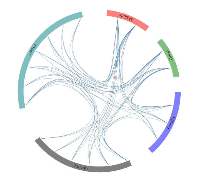
Yayınlar & Eserler

SCI, SSCI ve AHCI İndekslerine Giren Dergilerde Yayınlanan Makaleler

Diğer Dergilerde Yayınlanan Makaleler

Hakemli Kongre / Sempozyum Bildiri Kitaplarında Yer Alan Yayınlar

Antarktika King George Adası birincil üretim ve etken faktörler

II. Kutup (Arktik ve Antarktik) Bilim Programı Çalıştayı, Türkiye, 12 - 13 Eylül 2018

ESR Dating Molluscs From Marine Terraces In Hatay Province Turkey

GSA Annual Meeting, Denver, Amerika Birleşik Devletleri, 25 - 28 Eylül 2016, cilt.48, sa.7, ss.288102

Fault Finding: Esr Dating Molluscs From Marine Terraces In Hatay Province, Turkey

GSA Annual Meeting, Baltimore, Amerika Birleşik Devletleri, 1 - 04 Kasım 2015, cilt.47, sa.7, ss.359

Marine Terraces Along The Mediterranean Coast Of The Antakya Graben, Turkey

International Workshop In The Framework Of Turkish - German Science Year 2013-2014, İstanbul, Türkiye, 31 Ağustos - 06 Eylül 2014, ss.13

Slipping up ESR Dating Molluscs from Marine Terraces in Hatay Province Turkey

GSA Annual Meeting, CHARLOTTE, NORTH CAROLINA, Amerika Birleşik Devletleri, 4 - 07 Kasım 2012, cilt.44, ss.296

Antakya Grabeni'nin jeoloji ve morfolojisi

Ulusal Jeomorfoloji Sempozyumu, Hatay, Türkiye, 4 - 06 Ekim 2012, ss.6

Kentlerin Savunmasında Jeomorfolojinin Katkısına Örnekler

Ulusal Jeomorfoloji Sempozyumu, Hatay, Türkiye, 4 - 06 Ekim 2012, ss.49

An Uplifting idea: ESR Dating Marine Terraces in Hatay Province, Turkey

GSA Annual Meeting, Minneapolis, Amerika Birleşik Devletleri, 9 - 12 Ekim 2011, cilt.43, sa.5, ss.273

Late Pliocene-Pleistocene paleostress regime in the Gulf of Izmit and surroundings, NW Turkey

33rd International Geological Congress, Oslo, Norveç, 6 - 14 Ağustos 2008, ss.1340229

Kuzey Anadolu Fay Zonu orta kesiminin morfometrik yöntemlerle incelenmesi

I. Ulusal Jeolojik Uzaktan Algılama Sempozyumu, Sivas, Türkiye, 22 - 23 Mayıs 2008, ss.43

İzmit-Adapazarı çöküntüsündeki Pliyo-Kuvaterner çökellerinin korelasyonu

Türkiye Kuvaterneri Çalıştayı VI, İstanbul, Türkiye, 16 - 18 Mayıs 2007, ss.7

Kinematics of the faults cutting the Pliocene deposits in the Gulf of Izmit and surroundings

International Workshop in Comparative Studies of the North Anatolian Fault and San Andreas Fault, İstanbul, Türkiye, 11 - 14 Ağustos 2006, ss.89

GPS Measurements on the western Marmara segment of the North Anatolian Fault

International Workshop in Comparative Studies of the North Anatolian Fault and San Andreas Fault, İstanbul, Türkiye, 11 - 14 Ağustos 2006, ss.41

GPS Measurements on the Western Marmara Segment of North Anatolian Fault

Modern Technologies, Education And Professional Practice In Geodesy And Related Fields, 3 - 04 Kasım 2005

GPS measurements along the North Anatolian Fault zone on the mid-Anatolia segment

IAG Symposium on Geodetic Deformation Monitoring - From Geophysical to Engineering Roles, Jaen, İspanya, 17 - 19 Mart 2005, cilt.131, ss.166-171 identifier identifier

Physical factors controlling urban planning disaster areas: Bartın, western Black Sea region

An international inter-disciplinary conference on: The Black Sea region: Past, present and future, İstanbul, Türkiye, 14 - 16 Ekim 2004, ss.36 Sürdürülebilir Kalkınma

GPS measurements on the western Marmara of North Anatolian Fault segment

5th International Symposium on Eastern Mediterranean Geology, Thessaloniki, Yunanistan, 14 - 20 Nisan 2004, ss.904-907

GPS measurements on the western Marmara of North Anatolian Fault segmen

5th International Symposium on Eastern Mediterranean, Thessaloniki, Yunanistan, 14 - 20 Nisan 2004, ss.901-903

İstanbul Boğazı ile Rezve Deresi arasındaki kıyı morfolojisini denetleyen faktörler

Sırrı Erinç Sempozyumu, İstanbul, Türkiye, 11 - 13 Eylül 2003, ss.166-171

GPS measurements along the North Anatolian Fault Zone on the Mid Anatolia segments

Int. Workshop on the North Anatolian, East Anatolian and Dead Sea Fault Systems: Recent Progress in Tectonics and Paleoseismology, Ankara, Türkiye, 31 Ağustos - 12 Eylül 2003, ss.88

Doğu Marmara Bölgesi’nde Multidisipliner bir Morfotektonik Çalışması

Türkiye Kuvaterneri Çalıştayı IV, İstanbul, Türkiye, 29 - 30 Mayıs 2003, ss.23-24

Quantitative geomorphology of the eastern Marmara region, NW Turkey

EGS - AGU - EUG Joint Assembly, Nice, Fransa, 6 - 11 Nisan 2003, ss.438

Disaster management and GIS: Pre-Earthquake

The International Symposium on Geographic Information Systems, İstanbul, Türkiye, 23 - 26 Eylül 2002, ss.593-601

The Coastal Information System of the Marmara Sea MARCIS

The International Symposium on Geographic Information Systems,, İstanbul, Türkiye, 23 - 26 Eylül 2002, ss.247-253

Disaster management and GIS Post Earthquake

The International Symposium on Geographic Information Systems, İstanbul, Türkiye, 23 - 26 Eylül 2002, ss.602-608

Physical Factors controlling the Urban Planning in Disaster Areas: Bartın, Northern Turkey

3. Remote Sensing of Urban Areas International Symposium, İstanbul, Türkiye, 11 - 13 Haziran 2002, ss.787 Sürdürülebilir Kalkınma

Geology and Morphotectonics of the Northern Part of The Gulf Of Saros, NW Turkey

Fourth Third International Turkish Geology Symposium, Work in Progress on the Geology of Turkey and Its Surrounding, Adana, Türkiye, 31 Ağustos - 04 Eylül 2001, ss.191

Morphotectonic features of the Armutlu peninsula: a remote sensıng and GIS based approach

Fourth Third International Turkish Geology Symposium, Work in Progress on the Geology of Turkey and Its Surrounding, Adana, Türkiye, 31 Ağustos - 04 Eylül 2001, ss.339

Geology of the Gulf Of Izmit, NW, Turkey

Fourth Third International Turkish Geology Symposium, Work in Progress on the Geology of Turkey and Its Surrounding, Adana, Türkiye, 31 Ağustos - 04 Eylül 2001, ss.127

Using optical and radar images in the classification and monitoring the coastal zones: A case study on the Sea of Marmara

Fourth Third International Turkish Geology Symposium, Work in Progress on the Geology of Turkey and Its Surrounding, Adana, Türkiye, 31 Ağustos - 04 Eylül 2001, ss.340

Enhanced lineament analysis and deformation modeling of active tectonic zones using satellite imagery, 17th August İzmit earthquake (Mw: 7.4) region

Fourth Third International Turkish Geology Symposium, Work in Progress on the Geology of Turkey and Its Surrounding, Adana, Türkiye, 31 Ağustos - 04 Eylül 2001, ss.333

İzmit Körfezi ‘nin morfotektonik evrimi

Türkiye Kuvaterneri Çalıştayı, İstanbul, Türkiye, 21 - 22 Mayıs 2001, ss.58-63

Morphotectonic evolution of the Gulf of Izmit, NW Turkey

EUG XI, Strasbourg, Fransa, 8 - 12 Nisan 2001, ss.176

Morfotectonic features of North Anatolian Fault Zone in the Eastern Marmara Region: A Remote Sensing Approach

International Symposium on Remote Sensing & Integrated Technologies, İstanbul, Türkiye, 20 - 22 Ekim 1999, ss.173-182

GIS in Geological Map Producing

International Symposium on Remote Sensing & Integrated Technologies, İstanbul, Türkiye, 20 - 22 Ekim 1999, ss.173-182

An example to geological applications in the geographic information systems: Digital geological maps of Western Pontides

Third International Turkish Geology Symposium, Work in Progress on the Geology of Turkey and Its Surrounding, Ankara, Türkiye, 31 Ağustos - 04 Eylül 1998, ss.204

Digital Geological Map of Western Black Sea Region

International Symposium on GIS/GPS, İstanbul, Türkiye, 15 - 18 Eylül 1997, ss.103-109

Kitap & Kitap Bölümleri

GPS Measurements along the North Anatolian Fault Zone on the Mid-Anatolia Segment

Geodetic Deformation Monitoring From Geophysical to Engineering Roles, Fernando Sansò and Antonio J. Gil , Editör, Springer, Berlin, ss.166-171, 2006

Metrikler

Yayın

77

Atıf (WoS)

48

H-İndeks (WoS)

4

Atıf (Scopus)

52

H-İndeks (Scopus)

4

Proje

17
BM Sürdürülebilir Kalkınma Amaçları