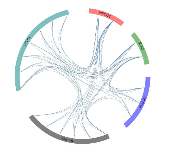
Yayınlar & Eserler

SCI, SSCI ve AHCI İndekslerine Giren Dergilerde Yayınlanan Makaleler

Diğer Dergilerde Yayınlanan Makaleler

Doğada Yön Tayini

Tabiat ve İnsan , cilt.35, sa.4, ss.3-9, 2001 (Hakemli Dergi)

Hakemli Kongre / Sempozyum Bildiri Kitaplarında Yer Alan Yayınlar

Centimeter-accurate Positioning with Handheld GNSS Receiver

XXXIII International Symposium on Modern Technologies, Education and Professional Practice in Geodesy and Related Fields, Sofija, Bulgaristan, 1 - 03 Kasım 2023, ss.13-23

Comparison of Machine Learning Regression Methods for Mass Real Estate Valuation

7th Intercontinental Geoinformation Days (IGD) (online), Peshawar, Pakistan, 18 - 19 Kasım 2023, ss.106-110

Digital Transformation of Campuses: The Role of HD Map

EUROPEAN TRANSPORT CONFERENCE, Milan, İtalya, 4 - 06 Eylül 2023, ss.1-14 Sürdürülebilir Kalkınma

Critical Issues in Emergency Planning for Nuclear Power Plant Accidents

6th Intercontinental Geoinformation Days (IGD) (online), Baku, Azerbaycan, 13 Haziran 2023, ss.266-269

Continuous Decimeters Level Real-time Precise Point Positioning in Polar High Latitude Region

6th Intercontinental Geoinformation Days (IGD) (online), Baku, Azerbaycan, 13 - 14 Haziran 2023, ss.233-237

A Mass Valuation Model Proposal for Residential Property Taxation in Türkiye

5th Intercontinental Geoinformation Days, New Delhi, Hindistan, 14 - 15 Aralık 2022

Gerçek-Zamanlı Çoklu-GNSS Hassas Nokta Konumlama (Multi-GNSS RT-PPP) Tekniğinin Performansının İncelenmesi

Türkiye Ulusal Jeodezi Komisyonu 2022 Yılı Bilimsel Toplantısı, Kocaeli, Türkiye, 02 Kasım 2022

iPad Pro LiDAR Sensörünün Kapalı Mekan Ölçmelerindeki Performans Analizi

TUFUAB 2022: XI. Türkiye Ulusal Fotogrametri ve Uzaktan Algılama Birliği Teknik Sempozyumu, Mersin, Türkiye, 12 Mayıs 2022, ss.83

Kırınım Izgarası Olarak CD Tabanlı Düşük Bütçeli Spektrometre Tasarımı

TUFUAB 2022: XI. Türkiye Ulusal Fotogrametri ve Uzaktan Algılama Birliği Teknik Sempozyumu, Mersin, Türkiye, 12 Mayıs 2022, ss.19

Sürdürülebilir Yeşil Kampüs Yönetimi İçin Karbon Ayak İzi Değişikliklerinin İzlenmesi

TUFUAB 2022: XI. Türkiye Ulusal Fotogrametri ve Uzaktan Algılama Birliği Teknik Sempozyumu, Mersin, Türkiye, 12 Mayıs 2022, ss.44 Sürdürülebilir Kalkınma

The Role of Geomatics Engineer In Smart Cities: A View Within The Framework of Turkish 2020-2023 National Smart Cities Strategy and Action Plan

The Sixth International Conference on the Smart City Applications (SCA'21) (Virtual/Online), Safranbolu, Türkiye, 27 - 28 Ekim 2021, ss.333-341 Sürdürülebilir Kalkınma identifier

Proposing A BIM-Based Model for Buıldıng Energy Optimization

International Symposium on Applied Geoinformatics (ISAG2021) (Virtual/Online), Riga, Letonya, 2 - 03 Aralık 2021

Easement Right Valuation for Power Lines

2nd Intercontinental Geoinformation Days (IGD) (online), Mersin, Türkiye, 5 - 06 Mayıs 2021, ss.100-103

Recent Advances and Perspectives for Accurate Positioning with Low-cost Smart Devices

2nd Intercontinental Geoinformation Days (IGD) (online), Mersin, Türkiye, 5 - 06 Mayıs 2021, ss.32-35

Comparison of Static PPP Performance of CSRS-PPP Float and Trimble RTX-PP Services

1st Intercontinental Geoinformation Days (IGD), Mersin, Türkiye, 25 - 26 Kasım 2020, ss.173-176

High-rate GNSS Precise Point Positioning (PPP)

XXIX International Symposium on Modern Technologies, Education and Professional Practice in Geodesy and Related Fields, İstanbul, Türkiye, 5 - 06 Kasım 2019, ss.20

Smart City Applications

XXIX International Symposium on Modern Technologies, Education and Professional Practice in Geodesy and Related Fields, İstanbul, Türkiye, 5 - 06 Kasım 2019, ss.41-42 Sürdürülebilir Kalkınma

Hassas Nokta Konumlama Yöntemi’nin Antarktika’da Kullanılabilirliği Üzerine Bir Araştırma

3. Ulusal Kutup Bilimleri Çalıştayı, Ankara, Türkiye, 5 - 06 Eylül 2019, ss.37-38

The Importance of Geospatial Data in the Smart City

2nd International Conference on Advanced Technologies, Computer Engineering and Science (ICATCES 2019), Türkiye, 26 - 28 Nisan 2019 Sürdürülebilir Kalkınma

Comparative Analysis of Multi-constellation GNSS Precise Point Positioning (PPP) in Kinematic Model

Geodesy for Smart Cities - GeoPreVi 2018 International Symposium, 29 - 30 Ekim 2018

Hassas Nokta Konumlama Tekniğinin (PPP) Ölçme Uygulamalarinda Kullanilabilirliği Üzerine Bir Araştirma

2nd International Vocational Science Symposium, Antalya, Türkiye, 26 - 29 Nisan 2018, ss.43-44

Social and Economic Monitoring and Evaluation of Land Consolidation Projects After Application

Proc. on FIG Congress 2018, Embracing Our Smart World Where the Continents Connect: Enhancing the Geospatial Maturity of Societies, 6 - 11 Mayıs 2018

3D Shoreline Mapping with Unmanned Aerial Vehicle

Proc. on FIG Congress 2018, Embracing Our Smart World Where the Continents Connect: Enhancing the Geospatial Maturity of Societies, 6 - 11 Mayıs 2018

Kinematic PPP Positioning Using Different Processing Platforms

Proc. on FIG Congress 2018, Embracing Our Smart World Where the Continents Connect: Enhancing the Geospatial Maturity of Societies, 6 - 11 Mayıs 2018

Değişen Dünyada Üniversitelerin Değişen Rolleri

ICOPFE-International Conference on Perspectives for Future Education, Girne, Kıbrıs (Kktc), 2 - 04 Mayıs 2018

Comparison of Single Baseline RTK and Network RTK GNSS Methods

Proc. on XXVII International Symposium on Modern Technologies, Education and Professional Practice In Geodesy and Related Fields, 9 - 10 Kasım 2017

Hassas Nivelman Yöntemi İle Deformasyon İzleme: Çorum Obruk Barajı Örneği

Avrasya Zirvesi, Uluslararası EJONS Matematik-Mühendislik ve Fen Bilimleri Kongresi, Ankara, Türkiye, 17 - 21 Temmuz 2017

Türkiye’nin Ekonomik ve Sosyal Kalkınma Hedeflerinde Kamu Üniversitelerinin Rolleri

The 2nd International Higher Education Studies Conference-IHEC 2017, 12 - 14 Ekim 2017

The Usage of Unmanned Aerial Vehicles (UAVs) for Cultural Heritage Mapping

The 19th International Symposium on Environmental Pollution and its Impact on Life in the Mediterranean Region-MESAEP 2017, 4 - 06 Ekim 2017

Establishment of Information Systems Within the Context of Sustainable Environmental Awareness: The case of Hitit University

The 19th International Symposium on Environmental Pollution and its Impact on Life in the Mediterranean Region-MESAEP 2017, 4 - 06 Ekim 2017 Sürdürülebilir Kalkınma

Sediment Monitoring In Dams with Bathymetric Survey for the Management of Natural Water Resources: Obruk Lake Dam Case

The 19th International Symposium on Environmental Pollution and its Impact on Life in the Mediterranean Region-MESAEP 2017, 4 - 06 Ekim 2017

Performance Measurement of Entrepreneurship Education in Hitit University

2nd World Conference on Technology, Innovation and Entrepreneurship, 12 - 14 Mayıs 2017

An Overview Of Internationalization Process In Higher Education Institutions

International Conference on Quality in Higher Education, Sakarya, Türkiye, 24 - 25 Kasım 2016

RSS Based Indoor Positioning with Weighted Iterative Nonlinear Least Square Algorithm

The Twelfth International Conference on Wireless and Mobile Communications-ICWMC 2016, 13 - 17 Kasım 2016, ss.106-109

Camilerin Hassas Kıble Tayini İçin Bazı Yöntem Öneriler

8. Ulusal Mühendislik Ölçmeleri Sempozyumu, İstanbul, Türkiye, 19 - 21 Ekim 2016

Obruk Barajı Deformasyon Ölçmeleri

8. Ulusal Mühendislik Ölçmeleri Sempozyumu, İstanbul, Türkiye, 19 - 21 Ekim 2016

Hidrografik Ölçme Standartlarına Genel Bir Bakış Türkiye İçin Bazı Öneriler

8. Ulusal Mühendislik Ölçmeleri Sempozyumu, İstanbul, Türkiye, 19 - 21 Ekim 2016

Hidrografik Ölçme Aracı Arıbot Mobil Lidar Entegrasyonu ve Test Ölçmeleri

8. Ulusal Mühendislik Ölçmeleri Sempozyumu, İstanbul, Türkiye, 19 - 21 Ekim 2016

An Applicable Roadmap For Post Secondary Vocational Education and Training System in Turkey

International Symposium on Post-Secondary Vocational Education and Training, Çorum, Türkiye, 12 - 15 Ekim 2016

Qibla Determination by Using GNSS A Case Study in Corum City

IAG Commission 4 Positioning and Applications Symposium, Wroclaw, Polonya, 4 - 07 Eylül 2016

Yükseköğretimde Değişim Küresel Trendler Ve Yeni Yapılanma Stratejileri

7th International Congress on New Trends in Education-ICONTE, Antalya, Türkiye, 13 - 15 Mayıs 2016

Precise Point Positioning PPP Technique versus Network RTK GNSS

Proc. on FIG Working Week 2016, Christchurch, Yeni Zelanda, 2 - 06 Mayıs 2016

Mesleki Teknik Eğitimde MYO ların Yeri 40 Yılında Çorum Meslek Yüksekokulu

Uluslararası Bütün Yönleriyle Çorum Sempozyumu, Çorum, Türkiye, 28 - 30 Nisan 2016

Üniversite Sanayi İşbirliklerinde Yeni Kurulan Üniversiteler İçin Model Arayışları Hitit Üniversitesi Örneği

Proc. International Conference on Quality in Higher Education (ICQH 2015), Sakarya, Türkiye, 2 - 04 Aralık 2015

Trilateration Technique for WiFi Based Indoor Localization

The Eleventh International Conference on Wireless and Mobile Communications-ICWMC 2015, Malta, 11 - 16 Ekim 2015, ss.25-28

Effect of Exchange Programs in Terms of Internationalization on University Industry Collaboration

International Teacher Education (ITEC 2015), St. Petersburg, Rusya, 2 - 04 Eylül 2015

Entrepreneurship Education at Universities: Suggestion for A Model Using Financial Support

World Conference on Technology, Innovation and Entrepreneurship, İstanbul, Türkiye, 28 - 30 Mayıs 2015, ss.856-861 Sürdürülebilir Kalkınma identifier

Usability of GNSS Technique for Cadastral Surveying

Proc. of the World Cadastre Summit, Congress Exhibition (WCS-CE), İstanbul, Türkiye, 20 - 25 Nisan 2015

Mühendislik Uygulamalarında Yöneylem Araştırması Tekniklerinin Kullanımı

TMMOB Harita ve Kadastro Mühendisleri Odası, 15. Türkiye Harita Bilimsel ve Teknik Kurultayı, Ankara, Türkiye, 25 - 28 Mart 2015

Statik ve Kinematik Uygulamalarda PPP Yönteminin Kullanılabilirliği

1. Konum Belirleme ve Uydu Navigasyonu Zirvesi 2015, İstanbul, Türkiye, 20 Mart 2015

An Overview of International Education in Higher Education from a Macro Perspective

International Distance Education Conference, Doha, Qatar, 18 - 20 Aralık 2014 Sürdürülebilir Kalkınma

Engelsiz Bir Üniversite için Deneyimlerden Öğrenme Hitit Üniversitesi Örneği

I. Uluslararası Engellilerin İstihdamı Sosyal Güvenlik Sorunları ve Çözüm Önerileri Kongresi, Ankara, Türkiye, 17 - 19 Ekim 2014

Otonom Hidrografik Ölçme Aracı İle Hidrografik Haritaların Üretilmesi

7. Ulusal Mühendislik Ölçmeleri Sempozyumu, Çorum, Türkiye, 15 - 17 Ekim 2014

Bilgi İşlem Felaket Kurtarma Merkezi Kurulumunda CBS ile Uygun Yer Seçimi

7. Ulusal Mühendislik Ölçmeleri Sempozyumu, Çorum, Türkiye, 15 - 17 Ekim 2014

Üniversite Yerleşkelerinde Wi Fi Erişim Noktaları Kullanılarak Konum Belirleme Çalışması

7. Ulusal Mühendislik Ölçmeleri Sempozyumu, Çorum, Türkiye, 15 - 17 Ekim 2014

New Approaches on Vocational Education and Training Trends Challenges Study for Students of Hitit University Vocational Higher School

International Conference on Education-2014 (ICE 2014), New Challenges and Solutions in Teaching and Coaching and Education Through Sport, Szombathely, Macaristan, 18 - 20 Eylül 2014

İstihdam Odaklı Mesleki Eğitim Uygulamalarında Yeni Yaklaşımlar Hitit Üniversitesi Örneği

1st International Vocational Education and Training Symposium (IVETS-2014), Bursa, Türkiye, 11 - 13 Eylül 2014 Sürdürülebilir Kalkınma

Üniversite Sanayi İşbirliğinde Teknokentlerin Önemi

1 st International Vocational Education and Training Symposium (IVETS-2014), Bursa, Türkiye, 11 - 13 Eylül 2014

Performance Analysis of PPP Technique Using GPS only and GPS GLONASS in Urban Environment

Melaha Conference 2014 Resilience Navigation, Alexandria, Kanada, 1 - 03 Eylül 2014

International Education within the Scope of Mevlana Exchange Program

5th Eurasian Silk Road Universities Consortium (ESRUC) Annual Meeting, Ulaanbaatar, Moğolistan, 24 - 26 Haziran 2014 Sürdürülebilir Kalkınma

Uluslararasi Öğrenci Hareketliliği ve Ülkelere Yansımaları

III. Uluslararası Türk Dünyası Ekonomi Formu (III-International Economical Forum of Turkic World), Almati, Kazakistan, 6 - 08 Haziran 2014

Üniversite Sanayi İşbirliği Ama Nasıl

Üniversite Sanayi İşbirliği Merkezleri Platformu (ÜSİMP) 7. Ulusal Kongresi (7th Congress on University-Industry Coorperation Centers Platform of Turkey), Kayseri, Türkiye, 22 - 23 Mayıs 2014

Kamu Hizmet Alanlarının Edinimi

IV. Arazi Yönetim Çalıştayı-AYÖP’2014, Trabzon, Türkiye, 12 - 13 Mayıs 2014

PPP Usability at Dynamic Environment

European Navigation Conference (ENC-GNSS 2014), Rotterdam, Hollanda, 15 - 17 Nisan 2014

Definition of E navigation User Needs in Turkey

European Navigation Conference (ENC-GNSS 2014), Rotterdam, Hollanda, 15 - 17 Nisan 2014

Comparison of Online PPP Service and Network RTK GPS TUSAGA Active

International Symposium on Global Navigation Satellite Systems 2013 - ISGNSS-2013, İstanbul, Türkiye, 22 - 25 Ekim 2013

Yurtdışında Yükseköğrenim Nedir ve Amaçları Nelerdir

International Symposium Kyrgyzstan-Russia: Milestones in Humanitarian Cooperation, Bishkek, Kırgızistan, 26 - 28 Eylül 2013

Kinematic PPP Performance of Low Cost GPS Receiver Using Online Post Processing Service

GNSS Precise Point Positioning Workshop: Reaching Full Potential, Ottowa, Kanada, 12 - 14 Haziran 2013

An Approach for Decimeter Level Positioning by Using Single Receiver in Hydrographic Applications

2nd International Conference on: Measurement Technologies in Surveying-GTP 2013, Warszawa, Polonya, 23 - 25 Mayıs 2013, ss.35-36

Performance Analysis of Trimble Center Point RTX Post Processing Service for GNSS Static Data

2nd International Conference on: Measurement Technologies in Surveying-GTP 2013, Warszawa, Polonya, 23 - 25 Mayıs 2013, ss.34

Performance Analysis of CORS Systems A Case Study in Corum

European Navigation Conference 2013 - ENC2013, Vienna, Avusturya, 23 - 25 Nisan 2013

Hydrographic Education in Turkey and Latest Trends in the World

XX. International Symposium on Modern Technologies, Education and Professional Practice In Geodesy And Related Fields, Varna, Bulgaristan, 23 - 24 Eylül 2010, ss.46-58

Performance Analysis of Precise Point Positioning Technique by Using Web Based Processing Service and Bernese Scientific Software

XX International Symposium on Modern Technologies, Education and Professional Practice In Geodesy And Related Fields, Varna, Bulgaristan, 23 - 24 Eylül 2010, ss.13

Producing GIS Aided Real Estate Appraisal Maps

XX International Symposium on Modern Technologies, Education and Professional Practice In Geodesy And Related Fields, Varna, Bulgaristan, 23 - 24 Eylül 2010, ss.164-174

Precise Point Positioning PPP Performance of Low cost GPS Receivers in Marine Applications Using On Line PPP Service

CPGPS 2010 Technical Forum on Satellite Navigation and Positioning, Shanghai, Çin, 18 - 20 Ağustos 2010, ss.1

Performance Analysis of Precise Point Positioning Technique for Surveying Applications

5th International Conference Exhibition-Melaha 2010, Cairo, Mısır, 3 - 05 Mayıs 2010

Deformation Monitoring Studies at Atatürk Dam

XXIV. FIG International Congress 2010, Sydney, Avustralya, 11 - 16 Nisan 2010

Evaluation of Recent Hydrographic Survey Standards

19th International Symposium on Modern Technologies, Education and Professional Practice In Geodesy And Related Fields, Sofija, Bulgaristan, 5 - 06 Kasım 2009, ss.116-130

Altyapı Bilgi Sistemlerinde Mobil CBS Uygulamaları İSKİ Altyapı Bilgi Sistemi Örneği

4. Ulusal Mühendislik Ölçmeleri Sempozyumu, Trabzon, Türkiye, 14 - 16 Ekim 2009, ss.227-235

Ambarlı Liman Bölgesinde Heyelan İzleme Çalışmalarında Son Durum

4. Ulusal Mühendislik Ölçmeleri Sempozyumu, Trabzon, Türkiye, 14 - 16 Ekim 2009, ss.353-364

Deformation Monitoring of Atatürk Dam

TIEMS 2009 Annual Conference, İstanbul, Türkiye, 9 - 11 Haziran 2009, ss.300-310

Precise Point Positioning Performance of Low cost OEM and Geodetic Receivers Using Online Processing Service

International Symposium on GPS/GNSS, Odaiba, Tokyo, Japonya, 11 - 14 Kasım 2008, ss.1144-1154

Rize Disaster Management And Meteorological Early Warning Systems

International Emergency Management Society, 15th TIEMS Annual Cenference-TIEMS2008, Prague, Çek Cumhuriyeti, 17 - 19 Haziran 2008

Usability Of Low Cost L1 Frequency GPS Receivers in Surveying Applications

Toulouse Space Show’08, European Navigation Conference (ENC-GNSS), Toulouse, Fransa, 22 - 25 Nisan 2008 identifier identifier

Centimeter Level Positioning With OEM Type GPS Receivers

International Symposium on Modern Technologies, Education and Professional Practice in Geodesy and Related Fields, Sofija, Bulgaristan, 8 - 09 Kasım 2007, ss.228-237

Düşük Maliyetli OEM Tipi GPS Alıcıları İle Konum Belirleme

3. Ulusal Mühendislik Ölçmeleri Sempozyumu, Konya, Türkiye, 24 - 26 Ekim 2007, ss.216-223

On The Use of Low Cost OEM GPS Receiver System for Surveying Applications

The 3rd International Symposium on Geo-Information for Disaster Management-Joint CIG / ISPRS Conference on Geomatics for Disasters and Risk Management, Toronto, Kanada, 23 - 25 Mayıs 2007

GPS GALILEO and GLONASS Satellite Navigation Systems GPS Modernization

2nd International Conference on Recent Advances in Space Technologies Space in the Service of Society, RAST 2005, İstanbul, Türkiye, 9 - 11 Haziran 2005, ss.390-394

Mobil Sistemlerle Coğrafi Bilgi Sistemi Uygulamaları Mobil Haliç Bilgi Sistemi Örneği

2. Ulusal Mühendislik Ölçmeleri Sempozyumu, İstanbul, Türkiye, 23 - 25 Kasım 2005, ss.591-603

Tokat Turhal İlçesi Coğrafi Bilgi Sistemi Projesi

2. Ulusal Mühendislik Ölçmeleri Sempozyumu, İstanbul, Türkiye, 23 - 25 Kasım 2005, ss.337-350

Mühendislik Yapılarında Deformasyon Ölçmeleri

2. Ulusal Mühendislik Ölçmeleri Sempozyumu, İstanbul, Türkiye, 23 - 25 Kasım 2005, ss.64-74

Forming The Geodetic Infrastructure of Engineering Projects by GPS and Different Levelling Methods

International Symposium on Modern Technologies, Education And Professional Practice In Geodesy And Related Fields, Sofija, Bulgaristan, 3 - 04 Kasım 2005, ss.169-178

Sularla Kaplı Alanlarımız ve Hidrografik Ölçmeler

TMMOB Harita ve Kadastro Mühendisleri Odası, 10. Türkiye Harita Bilimsel ve Teknik Kurultayı, Ankara, Türkiye, 28 Mart - 01 Nisan 2005

Ulaştırma Yapılarına İlişkin Mühendislik Projelerinde Yatay Düşey Kontrol Ağlarının Oluşturulması Üsküdar Ümraniye II Etap Hafif Metro Projesi Örneği

TMMOB Harita ve Kadastro Mühendisleri Odası, 10. Türkiye Harita Bilimsel ve Teknik Kurultayı, Ankara, Türkiye, 28 Mart - 01 Nisan 2005

GPS, GALILEO and GLONASS satellite navigation systems & GPS modernization

2nd International Conference on Recent Advances in Space Technologies, İstanbul, Türkiye, 9 - 11 Haziran 2005, ss.390-394 identifier identifier

Barajlarımız ve Hidrografik Ölçmeler DSİ Genel Müdürlüğü

1. Ulusal Barajlar ve Hidroelektrik Santrallar Sempozyumu, Ankara, Türkiye, 1 - 03 Haziran 2004, ss.591-599

İnternet Ortamında Coğrafi Bilgi Sistemi Uygulaması Web Tabanlı Haliç Bilgi Sistemi WHBS

TUJK 2003 Yılı Bilimsel Toplantısı Coğrafi Bilgi Sistemleri ve Jeodezik Ağlar Çalıştayı, Konya, Türkiye, 24 - 26 Eylül 2003, ss.146-154

A Mobile GIS Application at the Estuary Halic The Golden Horn in Istanbul

First International Conference Studying Land Use Effects in Coastal Zones with Remote Sensing and GIS, Kemer, Antalya, Türkiye, 13 - 16 Ağustos 2003, ss.119-127

Internet Based GIS Implementations A Case Study in an Ancient Settlement of Istanbul

ISPRS WG VII/4 Symposium Remote Sensing of Urban Areas, Regensburg, Almanya, 27 - 29 Haziran 2003, ss.11-17

Mühendislik Ölçmeleri Uygulamaları ve Ülkemizdeki Sorunları

TMMOB Harita ve Kadastro Mühendisleri Odası, 9. Türkiye Harita Bilimsel ve Teknik Kurultayı, Ankara, Türkiye, 31 Mart - 04 Nisan 2003, ss.419-426

Hassas Batimetrik Ölçmeler ve Haliç Uygulaması

TMMOB Harita ve Kadastro Mühendisleri Odası, 9. Türkiye Harita Bilimsel ve Teknik Kurultayı, Ankara, Türkiye, 31 Mart - 04 Nisan 2003, ss.461-474

GPS Standard Positioning Service Performance After Selective Availability Turned Off

International Symposium on Geographic Information Systems, İstanbul, Türkiye, 23 - 26 Eylül 2002, ss.25-33

Deformation Monitoring With Geodetic and Geotechnical Methods Case Study In Ambarli Region

International Symposium on Geographic Information Systems, İstanbul, Türkiye, 23 - 26 Eylül 2002, ss.354-364

Sub meter Level Kinematic GPS Point Positioning By Using Single Geodetic Receiver For Hydrographic Surveying

International Symposium on Geographic Information Systems, İstanbul, Türkiye, 23 - 26 Eylül 2002, ss.508-514

Internet Based Geographic Information System A Case Study

Third International Symposium Remote Sensing of Urban Areas, İstanbul, Türkiye, 11 - 13 Haziran 2002, ss.788-795

Establishing a Current Address Information from Ikonos Images for Geographic Information System

Third International Symposium Remote Sensing of Urban Areas, İstanbul, Türkiye, 11 - 13 Haziran 2002, ss.796-803

The Effect of Common Point Density and Number in 3 D Coordinate Transformation

International Symposium on Modern Information and GPS Technology-Aspects and Implications of Their Application, Sofija, Bulgaristan, 8 - 09 Kasım 2001, ss.263-270

The Vertical Results of the Ambarli Deformation Measurements by Geodetic Methods

International Symposium on Modern Information and GPS Technology-Aspects and Implications of Their Application, Sofija, Bulgaristan, 8 - 09 Kasım 2001, ss.150-159

Verification of the Simplified Model for Thermal Discharges

Third Black Sea International Conference, Environmental Protection Technologies For Coastal Areas, Varna, Bulgaristan, 6 - 08 Haziran 2001, ss.61-70

Islah Öncesi ve Sonrası Haliç Dip Topografyasındaki Değişim

Haliç 2001 Sempozyumu, İstanbul, Türkiye, 3 - 04 Mayıs 2001, ss.282-296

Hydrographic Charts From Portolan to Electronic Charts

Fourth International Symposium Turkish-German Joint Geodetic Days, Berlin, Almanya, 3 - 06 Nisan 2001, cilt.2, ss.655-662

The Use of Satellite Based Navigation Systems in Urban Areas

Fourth International Symposium Turkish-German Joint Geodetic Days, Berlin, Almanya, 3 - 06 Nisan 2001, cilt.1, ss.267-274

Comparison of GPS and Precise Leveling Derived Height Differences in Urban Area

Fourth International Symposium Turkish-German Joint Geodetic Days, Berlin, Almanya, 3 - 06 Nisan 2001, cilt.2, ss.671-678

Landslide Monitoring Project by Using Different Techniques

Fourth International Symposium Turkish-German Joint Geodetic Days, Berlin, Almanya, 3 - 06 Nisan 2001, cilt.2, ss.663-670

The Results of the New Galata Bridge Deformation Measurements by Using Different Methods

International Symposium on Modern Information and GPS Technology-Aspects and Implications of Their Application, Sofija, Bulgaristan, 11 - 12 Kasım 1999, ss.302-312

The Applicability of GPS Aided Vessel as a Tide Gauge by Using Kalman Filtering Technique

The International Symposium on GPS, Earthquake Research Institute, Tsukuba, Japonya, 18 - 24 Ekim 1999

Surveying Engineering on the Internet

International Symposium on Remote Sensing and Integrated Technologies, İstanbul, Türkiye, 21 - 23 Ekim 1999, ss.349-359

Determination of Qibla Direction of New Mosques in Istanbul Using Global Positioning System

International Symposium on Remote Sensing and Integrated Technologies, İstanbul, Türkiye, 21 - 23 Ekim 1999, ss.267-272

A Research On The Role of the Geoid Undulations in 3D Transformation

International Symposium on Remote Sensing and Integrated Technologies, İstanbul, Türkiye, 21 - 23 Ekim 1999, ss.301-310

Determination of Mean Sea Level with GPS on Vessels

12th International Technical Meeting of The Satellite Division of The Institute of Navigation, ION GPS-99, Nashville, Tennessee, 14 - 17 Eylül 1999, ss.1323-1330

Modern Hydrographic Surveying and Automatic Data Acquisition Systems ADAS

Third Turkish-German Joint Geodetic Days, İstanbul, Türkiye, 1 - 04 Haziran 1999, ss.285-294

The Corrections that will Bring to the Depth Measurements Determined by the Acoustic Method

Third Turkish-German Joint Geodetic Days, İstanbul, Türkiye, 1 - 04 Haziran 1999, ss.671-680

XXI Yüzyıla Girerken Jeodezi ve Fotogrametri Mühendisliği Öğretiminin Mevcut Durumu ve Sorunları

TMMOB Harita ve Kadastro Mühendisleri Odası, 6. Türkiye Harita Bilimsel ve Teknik Kurultayı, Ankara, Türkiye, 3 - 07 Mart 1997, ss.333-342

Haliç Islah Projesi

TMMOB Harita ve Kadastro Mühendisleri Odası, 6. Türkiye Harita Bilimsel ve Teknik Kurultayı, Ankara, Türkiye, 3 - 07 Mart 1997, ss.421-430

İTÜ Rektörlüğü Araştırma Projeleri Veri Tabanı

İnşaat Mühendisliğinde Bilgisayar Kullanımı V. Sempozyumu, İstanbul, Türkiye, 17 - 19 Haziran 1996

Harita Projelerinin Çağdaş Yönetimi

Zonguldak Karaelmas Üniversitesi, Mühendislikte 20. Yıl Sempozyumu, Zonguldak, Türkiye, 5 - 06 Ekim 1995, cilt.2, ss.1-8

Alibey Barajı nda Deformasyon Ölçmeleri ve 1987 1994 Sonuçları

Zonguldak Karaelmas Üniversitesi, Mühendislikte 20. Yıl Sempozyumu, Zonguldak, Türkiye, 5 - 06 Ekim 1995, cilt.7, ss.1-12

İstanbul Metrosu nda Enkesit Ölçmeleri

TMMOB Harita ve Kadastro Mühendisleri Odası, 5. Türkiye Harita Bilimsel ve Teknik Kurultayı, Ankara, Türkiye, 31 Ocak - 03 Şubat 1995, ss.297-307

The Results of The Deformation Research Project of Alibey Dam

1st Turkish International Symposium on Deformations, İstanbul, Türkiye, 5 - 09 Eylül 1994, ss.512-523

Deformation Measurements on the New Galata Bridge and its Surrounding Area

1st Turkish International Symposium on Deformations, İstanbul, Türkiye, 5 - 09 Eylül 1994, ss.1139-1149

Kitap & Kitap Bölümleri

Usability of GNSS Technique for Cadastral Surveying

Cadastre: Geo-Information Innovations in Land Administration, Yomralioglu, Tahsin, McLaughlin, John (Eds.), Editör, Springer International Publishing, New Delhi, ss.77-91, 2017

Metrikler

Yayın

261

Atıf (WoS)

368

H-İndeks (WoS)

11

Atıf (Scopus)

411

H-İndeks (Scopus)

11

Proje

13

Açık Erişim

2
BM Sürdürülebilir Kalkınma Amaçları